Facts.
Total area: 1,104,300 sq km
Land area: 1,000,000 sq km
Water area: 104,300 sq km
Size comparitive to US territory: slightly less than twice the size of Texas
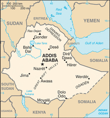
Countries that share a border: Dijibouti, Eritrea, Kenya, Somalia, South Sudan, Sudan.
Total distance of all land Boundaries: 5,328 km
Total distance of coastline: 0 km
Description of Climate: tropical monsoon, with a wide variety of climates varying depending on where you are at.
Description of terrain: High plateau with central mountain range divided by the Great Rift Valley.
point of lowest elevation: Danakil Depression: -125 meters
Point of highest elevation: Ras Dejen: 4,533 meters
Land area: 1,000,000 sq km
Water area: 104,300 sq km
Size comparitive to US territory: slightly less than twice the size of Texas
Countries that share a border: Dijibouti, Eritrea, Kenya, Somalia, South Sudan, Sudan.
Total distance of all land Boundaries: 5,328 km
Total distance of coastline: 0 km
Description of Climate: tropical monsoon, with a wide variety of climates varying depending on where you are at.
Description of terrain: High plateau with central mountain range divided by the Great Rift Valley.
point of lowest elevation: Danakil Depression: -125 meters
Point of highest elevation: Ras Dejen: 4,533 meters
|
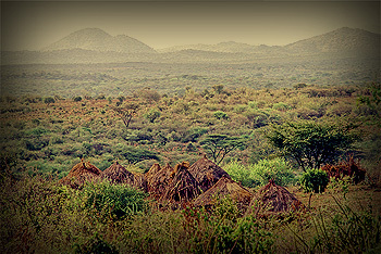
above, Ethiopian foothills.
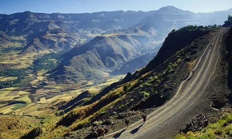
left, a large Ethiopian plain. |
|
