Facts.

Total area: 92,090 sq km
Land area: 91,470 sq km
Water area: 620 sq km
Size comparitive to US territory: roughly the size of Indiana
Countries that share a border: Spain
Total distance of all land Boundaries: 1,214 km
Total distance of coastline: 1,793 km
Description of Climate: Temperate maritime, cool and rainy in the north, warmer and drier in the south.
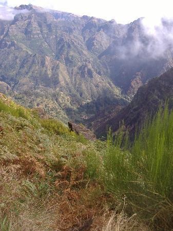
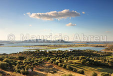
Description of terrain: mountainous north of the Tagus river, rolling plains in the south
point of lowest elevation: Atlantic ocean: 0 meters
Point of highest elevation: Ponta do Pico :2,351 meters
Land area: 91,470 sq km
Water area: 620 sq km
Size comparitive to US territory: roughly the size of Indiana
Countries that share a border: Spain
Total distance of all land Boundaries: 1,214 km
Total distance of coastline: 1,793 km
Description of Climate: Temperate maritime, cool and rainy in the north, warmer and drier in the south.
Description of terrain: mountainous north of the Tagus river, rolling plains in the south
point of lowest elevation: Atlantic ocean: 0 meters
Point of highest elevation: Ponta do Pico :2,351 meters
|
To the left, Portugal's mountains.
Directly above, Portugal's plains |
|
